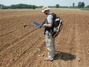
Field measures are key activities of Earth Observation (EO) sciences. The generation of remote sensing products often depends on calculations based on in-situ measurements. As an example, it can be mentioned the use of analytical models for the estimation of bio-geophysical parameters, which usually takes advantage from physical relations calibrated with in-situ measures about the bio-optical properties of natural surfaces. Field activities are also performed in order to collect measures comparable with satellite derived data; in this way the accuracy of algorithms implemented for the generation of thematic maps can be evaluated. Furthermore, the collection and analysis of field data by means of scientific instrumentation used both in-situ and in laboratory, is a good way to have a large database for the understanding and/or modelling of interaction processes between electromagnetic energy and natural surfaces. In general, in-situ measures allow a database for both the interpretation of remote sensed data and for the elaboration of the electromagnetic signal to be generated, with positive impacts on EO techniques in the scientific field and for the satisfaction of different stakeholders’ requirements (end-users). Within this context IREA has a long experience carried on thanks to important investments on state-of-the-art instrumentation (e.g. spectroradiometers, thermal camera, solar photometers) and the development of prototypes (e.g. multi-angular goniometer, sampling technique for water fluxes using flow-through method), purposely designed to satisfy the needs of the research activity.
In the following links the field campaigns performed during the last years with the scientific instrumentation of IREA (see also "Labs and instruments")
2000, 2001, 2002, 2003, 2004, 2005, 2006, 2007, 2008, 2009, 2010, 2011


