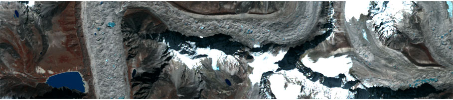

Traditionally Big Data means heterogeneous, multi-source, non-structured information on the Web characterized by huge volumes, great velocity of updating and high semantic variability. The interest of research on the links between Big Data and geography is highly increasing.
The ability of detecting, interpreting and analyzing Big Data, created by smart, mobile applications to signal, comment or document by photos, videos, etc. critical environmental events witnessed by the providers, can fruitfully help in different situations: to prevent catastrophic accidents, to monitor the territory evolution, to plan mitigation activities and resource distribution during both ordinary management and emergencies, and to improve population security.
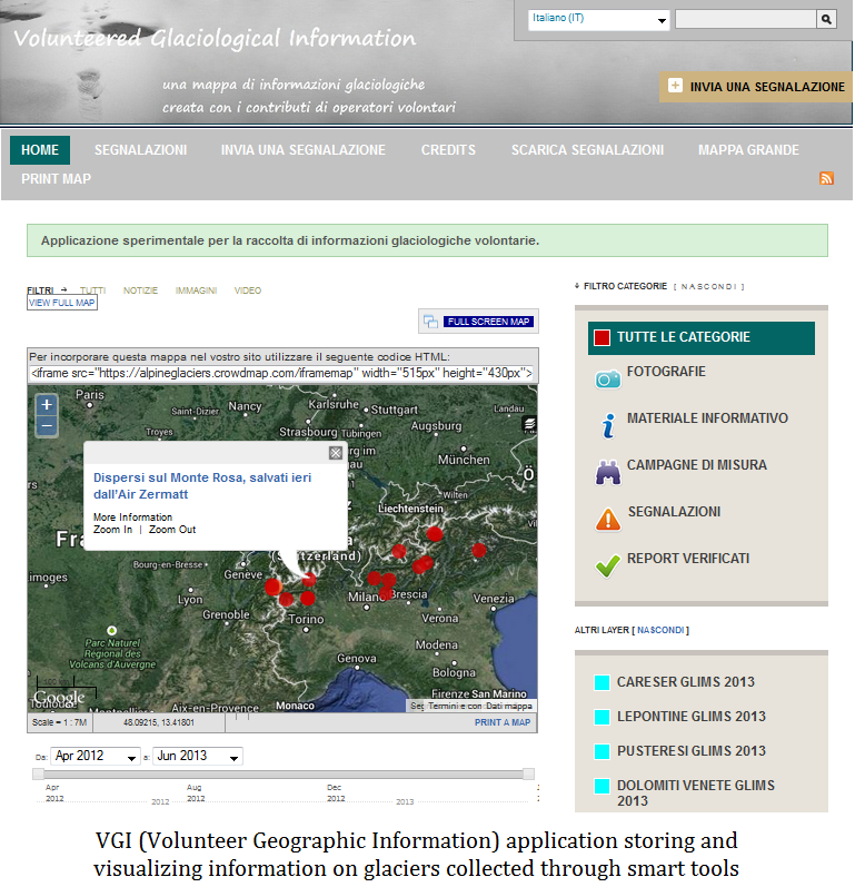
Big Data often includes either explicit geographic content, with GPS coordinates, or implicit, expressed by names of geographic locations in the texts, which is created and shared on the Web by social tools such as Twitter, FaceBook or specific applications for geographic information such as Foursquare, Ushahidi, etc.
Managing Big Data involves multiple techniques related to various disciplines such as Information Retrieval of textual documents for searching, lexical analysis, and representation of the contents of interest; techniques of interoperable managing and sharing of geo-information for mapping spatial references; spatio-temporal data mining for contextual content analysis; and at last techniques of validation of the quality of heterogeneous, multi-media information.
Usually, this information type is affected by uncertainty and imprecision: hence its management requires appropriate methods such as statistics and soft computing.