
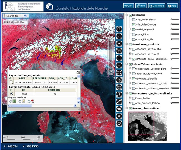
For years IREA has hosted and delivered data produced during research activities by means of OGC geoservices for managing maps (WMS), coverages (WCS), features (WFS), and observations from sensors (SOS).
It also delivers online standard processing modules (WPS) to let users perform some elaboration on the delivered data. All data and services are described by metadata compliant with the European INSPIRE recommendations and hosted in a Catalogue Service to be searched by the public.
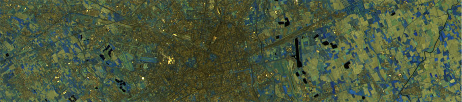
One of the results of this activity is the Geoportal; you can find examples of navigation criteria of a Geoportal at: http://ows.ise.cnr.it/demo/map.phtml. Information of such a Geoportal refer to spatial and geopraphical information produced within national or international IREA projects, such as snow cover of local glaciers, burned areas in Africa or water quality of Lake Garda. They give an exhaustive idea of applications IREA has produced within its research topics, in particular the Topic Geografic Information Systems.
Here are other "demo" of IREA geoportals referred to particolar areas in Italy and abroad.
Visit the Geoportal of Garda LakeVisit the Geoportal developed within the European Project IDE-Univers