Displaying items by tag: remote sensing
Monday, 06 December 2010 11:40
Differential Synthetic Aperture Radar Interferometry
Thursday, 15 January 2015 10:50
Geophysical modeling of remote sensing data and geodetic measurements
Monday, 19 January 2015 08:46
GRID and Cloud platforms exploitation for the interferometric processing of SAR data
Wednesday, 20 October 2010 09:56
Thematic Mapping
Friday, 26 November 2010 14:51
Evaluation of bio-geophysical parameters using physically based models
Monday, 07 February 2011 11:49
Environmental and natural resources monitoring
Monday, 18 November 2024 14:40
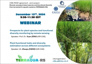
Remote sensing and plant diversity: a webinar of the TERRAQUA-RS project
Tuesday, 17 September 2024 15:55
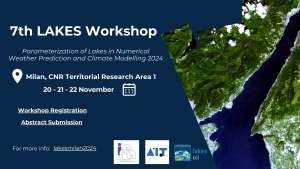
7th LAKES Workshop / 20-21-22 November / Milan
Friday, 27 July 2012 14:04
An international prize for the satellite monitoring techniques developed at IREA
Friday, 08 June 2012 09:48
Earthquake in Emilia Romagna: satellites measure the ground displacements
Tag Cloud
Research activity in evidence
-
Interaction between electromagnetic fields and nanoparticles
According to an estimate of the World Health Organization, about…


